
You may have chanced upon this page by accident. Here’s our new blog site.
http://blog.arrowdynamiclabs.com


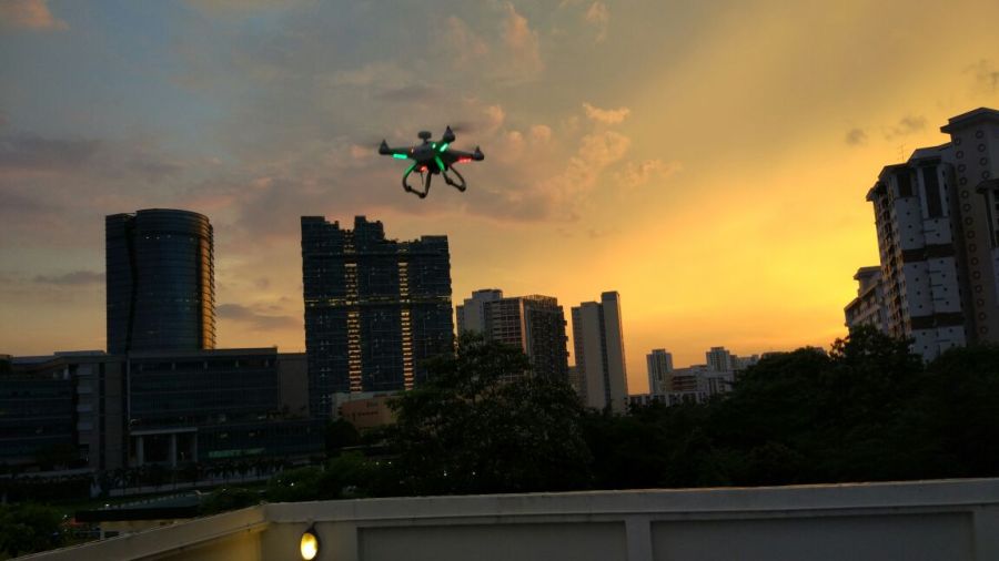
3D Mapping is commonly used in the construction, mining, agriculture etc. A clear model and photo of your subject will allow for good decision making. With multiple softwares available in the market, it has become easier to conduct drone mapping. ADLABS is currently conducting drone mapping in Indonesia as part of research and development.
Being an entry level drone mapper, its all about flight planning. Ensure safety is the utmost priority. It is important to consider trees and structures prior to flight ontop of a well maintained drone. Understanding your software well and running adequate pre-flight tests will ensure you do not loose your drone in the progress. Note that it only takes one semi colon to ruin your flight.
This post highlights some most commonly used apps and programs, you should still consider each software well before making an investment of your time and money.
https://www.dji.com/ground-station-pro/3d-map-poi
https://www.precisionhawk.com/precisionmapper
PrecisionMapper allows processing of aerial data into 2D,3D and has an expanding library of analysis tools. There is a paid membership plan and includes a free membership option which allows basic 5 cloud based 2D/3D maps per month. The free version also has ground control points and access to free analysis tools for different industries. This is and ideal opportunity for many beginners to get their hands on drone mapping technology.
Click here to start your first drone mapping project with PrecisionMapper by precisionhawk App http://geoawesomeness.com/step-step-guide-complete-first-drone-mapping-project/
A standalone software that performs photogrammetric processing of digital images and generates 3D Spatial Data.You can try this software on a 30 day free trial. The standard option is about $179 and professional edition is $3499 USD. The software once purchased can only work on one computer, unlike the Pix4D which can be installed in two. Features include photogrammetric triangulation, 3D model generation. The professional version allows thermal imaging and 4D modelling for dynamic scenes. There are inbuilt tools that conduct seemingly accurate measurements such as volume, distance and area.
With 10 years of being in the market, Agisofts software is known to be the best off the shelf softwares for the various industries.
With a flexible option of renting the software on a monthly basis you can also purchase it with a one off fee with support for one year. However it is also the most expensive software and also the most advanced.
Pix4D has inbuilt feature such as mesh editing to give you a clear model, 360 degree camera option which allows you to capture more within a shorter period. This software offers the most accuracy on its models with an automatic workflow. Its known to be simply the best option for all the mapping requirements you have and applicable to most industries.
http://verticalinspection.com/
VertSpec allows mapping of vertical object such as towers,bridges, buildings VertSpec is still under its developmental stages. You are allowed to sign up for its pilot and industry beta testing program.
DroneDeploy is a great 3D mapping tool for beginners. Drone deploy has decent three level pricing for individuals to enterprise level use with a 14 day free trial. If you want a good range of export options, export 3D data, measure volumes and group control points you have to upgrade to the paid version. Once upgraded, you can export to Blender, Rhino, AutoCad etc. The program is also offered on iOS and Andriod where you can make interactive maps and models. The program is also easy to use as it allows automatic flight profile within the required mapping area.
The software is highly compatible with most drones, across 120 countries and it is a good starting point for most users. However advanced users might eventually shift.
Like every other software, there ought to be bugs and fixes. You can follow the latest bug reports and feedback here and better understand the issues you might face in the long run. It is always good to consider a software with good support and online community. https://forum.dronedeploy.com/c/bug-reports-feedback
Here are some startups that conduct drone inspections and monitoring. https://www.nanalyze.com/2017/07/7-drones-inspections-monitoring/
Ever wondered why DJI Drones are so stable and yours is flipping like prata? There are many reasons and one of it leads to tuning your PID. Lets assume you are new to drones, and you really want to know just the right amount about PID. Here’s a summary post of everything you need to know about PID for a start.. The information is compiled from experience and personal resources. The control theory behind PID will be avoided to allow younger readers to understand. -B.KANESH
Relevant topics : #Control Theory, #Aircraft Stability Modes, #Drones, #Multicopter #PID #StableDrone #STEM #Singapore
Drones have a standard 3 axis angular change which are namely roll, pitch and yaw. Thrust can be related to the vertical ascent and decent in multirotors and forward motion in aircraft. This can be tuned using throttle curve. However in PID we mainly relate to the movement /response along the 3 common axis. The brain or microcontroler tries to correct the error calculated between a measurement at the controller input (measured by gyros) and a input set point (position of joystick) and drives the motors to attempt to return the drone to the initial position.
The combination of measured angluar deivation and sampling the change over time provides information to the controller that assists the drone to return to equilibrium only with a gyroscope.
In most cases several online resources will guide you to your first set of PID values. These are subjective to the setup. Therefore use these values as a start point to your tuning. Remember tuning is to suit your flying style. If you are considering a PID for anyone, you should consider values that lead you to a slower response on the drone with large set point rates on the controller. The new users usually tend to control the stick more dramatically as compared to experienced pilots. Do note that slow response should only be when there is an input from the controller, the drone should be programmed to attain stability when there is no input. This is known as active flight recovery. This is basically how DJI suits everyone.
Increasing P : Drone will become stable until it reaches a maximum point before it starts to become unstable again. It will oscillate and loose control. You will also notice a very strong resistant force to any attempts to move the drone.
Decreasing P : The drone will start to drift in control until P is too low, it will become unstable. It will be less resistant to any attempts to change orientation.
Further Explanation : The amount of force is proportional to a combination of the deviation from the initial position minus any command to change direction from the controller input. A higher P value will create a stronger force to reisist any attempts to change its position. If the P value is too high, on the return to initial position, it will overshoot and the opposite force is needed to compensate. This creates an oscillating effect until stability is reached. If you have too much of P, the drone can become completely unstable.
Increasing I – This increases the ability to hold the overall initial position and reduce drifting. This also increases the delay in returning to the original position. The amount of force. Increasing I also decreases the effect of P.
Decreasing I: Will improve the reactions to changes however will increase drift and reduce ability to hold position. It will also increase the importance of P.
Further Explanation : The amount of force applied to return to the original position is increased by I. The longer longer the deviation exists until a maximum force value is reached. A higher I will increase the heading hold capability.
Increasing D : Improves the speed at which deviations are recovered. With a better recovery speed comes a higher chance of overshooting and oscillations. Increasing D will also increase the effect of P.
Decreasing D : Reduces the oscillations when returning any deviations to their initial position.Recovery to initial position also becomes slower. This will also decrease the effect of P.
For Stable flight (Recommended for Autopilot/First Person View)
For Stunt/Aerobatic flying
You can also do this procedure without holding your drone if you have a initial settings applied. This is called Altitude PID tuning.
ADLABS runs enrichment workshops Technology, Science & Engineering Education. You can sign up for our workshops for 2018 soon. Email us adlabssg@gmail.com
Mr Kanesh currently works as a part-time engineer with local technology start-up In.Genius, which hopes to send the first Singaporean to space.
The self-professed tinkerer also has his own start-up that conducts science and technology workshops for young people, and he is involved in community service and grassroots work too.
“A lot of people will say, I do not have time to do this, I do not have time to do that. But it is really about making time, which comes back to time management,” he said.
Read more about Kanesh here : https://www.tnp.sg/news/singapore/fighting-cancer-while-pursuing-his-dreams?utm_term=Autofeed&utm_campaign=Echobox&utm_medium=Social&utm_source=Facebook#Echobox=1532485256


ADLABS will be the first to conduct its new drone workshops based on the DJI Tello. The first of dji’s drones that supports SDK and scratch block based programming. Endless possiblilities and dynamite abilities. Arrowdynamic Laboratories will introducing the new drone into its curriculum during its new workshops conducted with IMDA Labs and National Library board.
Fun with Drones Workshop (2-3hrs) – Suitable for 9-12 Years of age
Fun with drone workshops introduce kids to drone flying. Safety is first so we use the most safest of the drones. Flying skills will be trained on simulators prior to actual flight.
Signup Now : https://goo.gl/forms/qSoLRmq4DWSEeEix2
Introduction to Drones (3-4hrs) – Suitable for age 12 and up
Introduction to drones is a free for all workshop to get in-depth insights to drone technology and drone flying. Covers a outline of all the information you need to know to start flying and building drones.
Signup Now : https://goo.gl/forms/qSoLRmq4DWSEeEix2
Drone Pro Course (20hrs) -Suitable for 16 and up
Our extended drone pro course includes building a drone from scratch suitable for ages above 16. You will learn the following skills.
Signup Now : https://goo.gl/forms/qSoLRmq4DWSEeEix2


Is your child prepared for today’s tests and tomorrow’s life challenges? Education is not about getting all the right answers- the best education equips your child with strong fundamental core skills to tackle every challenge ahead.
Here are 10 useful benefits not only for school, but also everyday life:
Find out more about our programming classes http://www.arrowdynamiclabs.com/primary.html
or contact us : http://www.arrowdynamiclabs.com/contact_us.html
http://scse.ntu.edu.sg/NewsnEvents/Pages/News-Detail.aspx?news=f8709447-b3c0-4332-8e62-caf8737b40a4
The SCE Techfest 2015 was held on the 17 February at the Nanyang Auditorium Foyer. The purpose of the annual TechFest is to create awareness on existing up-to-date gadgets and technologies for students and professors from all faculties in NTU. It is organized by the Computer Engineering Club (CEC) in collaboration with the School of Computer Engineering (SCE). It serves as a venue for the public to discover the importance on the usage of technology as well as its benefits to society today.
SCE Chair, Prof Thambipillai Srikanthan graced the event and it drew over 30 professional groups showcasing at the booths and the event had an estimated turn up of 450 people. There were a series of activities lined up for all participants such as CEC Hackathon Competition, stage games, console gaming contests and Instagram contests.
Some of the external companies that participated in the event included:
1) DSO National Laboratories
2) Singapore Institute of Manufacturing Technology
3) ArrowDynamic Laboratories
4) FYND
5) TRIPDA
6) Paywhere
7) Version 2

Fun with drones workshop was held this December at Thinkel Learning Lab. At thinkel, the class size is limited so that students get longer hands on time to explore the world of drones and robotics. We allow the students to gain insights to how drones can be flown. Did you know that there are 4 types of control modes? For an aircraft type drone you need to cotnrol 4 axis at the same time for sustained flight. For the new year, more exciting programs are coming up while we continue to work with Thinkel Learning Lab and Bukit Batok CSC. Arrowdynamic Laboratories has been constantly developing new programs for kids under the applied learning and STEM program. Find out more http://arrowdynamiclabs.com/thinkel.html


On the grounds of the Nanyang Technological University (NTU) lies a site of brutal violence – a graveyard of drones where almost 600 of them met their grisly end by crashing into a crash-test dummy head.
These damaged drones are part of a large-scale study done for the first time here to test the impact of drones of various weights landing on someone’s head from different heights.
With this study, government agencies can have scientific data to work with when coming up with future regulations to manage safe drone operations in urban Singapore.

Our Founder B.KANESH was mentioned in NTU Hey! Magazine for his work with NTU High Altitude ballooning project. Click here to read full article. We would like to take this opportunity to motivate more individuals to take up programming and prototyping which he claims was vital to his project’s success. He believes through skills obtained while you are young, you can explore into solving more complex solutions creatively when you are exposed to new environments when you are much older. Here are some of his tips to stand out from the crowd …
